
Browse Wheat Ridge Street Directory
A street-by-street search begins with a normalized address, not a guessed name. Wheat Ridge uses a Denver Metropolitan addressing system. Keep the direction, street type, unit, city, and ZIP exactly as the portal expects, then preserve old spellings in a second note. The result can show an owner or parcel, but it cannot promise a full list of people at the site. The Wheat Ridge street directory becomes more useful when the same address is tested against a map, deed, voter, permit, and historical source.
Use this order for a current address:
- Enter the street number, direction, street name, street type, city, ZIP, and unit in the Jefferson County Assessor address mode.
- Open the matching PIN or AIN and copy the property address, mailing address, legal description, and history or sales document number.
- Open Jefferson County GIS, select the parcel, and note the neighboring polygons, frontage, public right of way, and map identifier.
- Search the recorder index by current owner, grantor or grantee, reception number, or legal description to find transfers.
- Use Colorado voter channels only for a defined person or approved election-data request, then use criss-cross directories for past occupants.
Note: The address chain separates owner, mailing recipient, occupant, voter, and permit applicant instead of treating them as one person.
Wheat Ridge Street Address Fields
Three address forms matter in Wheat Ridge. The situs or property address names the parcel location. The mailing address tells the Assessor where notices or owner mail go and can be outside the city. The legal description identifies the land through block, lot, tract, section, township, range, quarter, sequence, or a metes-and-bounds description. An address search can fail when an old number changed, a unit is omitted, or the researcher uses a mailing value in place of the situs address.
- Situs address
- The physical property address used by the Assessor, GIS, permits, many maps, and code records.
- Mailing address
- The address connected to owner correspondence, which may be a PO box, agent, trust, or different city.
- Parcel
- A mapped piece of land with a county identifier, legal description, and property-record card.
- Plat
- A recorded or approved land survey that helps connect streets, lot lines, monuments, and legal descriptions.
When a street number does not return a result, switch to the subdivision, PIN, AIN, owner name, document number, or lot and block. Wheat Ridge subdivision rules require legal-description and lot-line material, which can bridge a current address to an older deed. Keep the source label beside every normalized address so a later directory lookup does not erase the historical form.
Wheat Ridge Street Assessor Search Fields
The Jefferson County Assessor address form is the core modern street directory tool. Direction and street type are required dropdown choices in the inspected address mode. City is required, and WHEAT RIDGE is available. Postal code is also required in that mode, with 80033 and 80034 among the relevant values. The portal runs the search after entry and exposes export controls on the result set.
| Field | Required | Observed options or use |
|---|---|---|
| Address Number | No | Numeric number, with partial behavior dependent on the portal |
| Pre-directional | Yes | E, N, NW, S, SE, SW, W |
| Street Name | No | Current spelling such as Main; try an older form if needed |
| Street Type | Yes | AVE, BLVD, CIR, CT, DR, LN, PKWY, RD, ST, TER, TRL, WAY, and more |
| Unit Number | No | Useful for a divided or multi-unit property |
| City | Yes | WHEAT RIDGE appears in the county city list |
| Postal Code | Yes | 80033 and 80034 are relevant Wheat Ridge values |
The address result columns include property address, city, postal code, PIN, AIN, TAG, owner, property class, and mailing address. Owner mode adds a last-name and first-name route. A result page can contain 50 rows with API Skip and Take paging, so a long street search needs a clear note of the filter and export date.
The Jefferson County Assessor address search is the source for the captured form below. It shows why a direction and street type matter before a Wheat Ridge street directory result can be compared with a map.
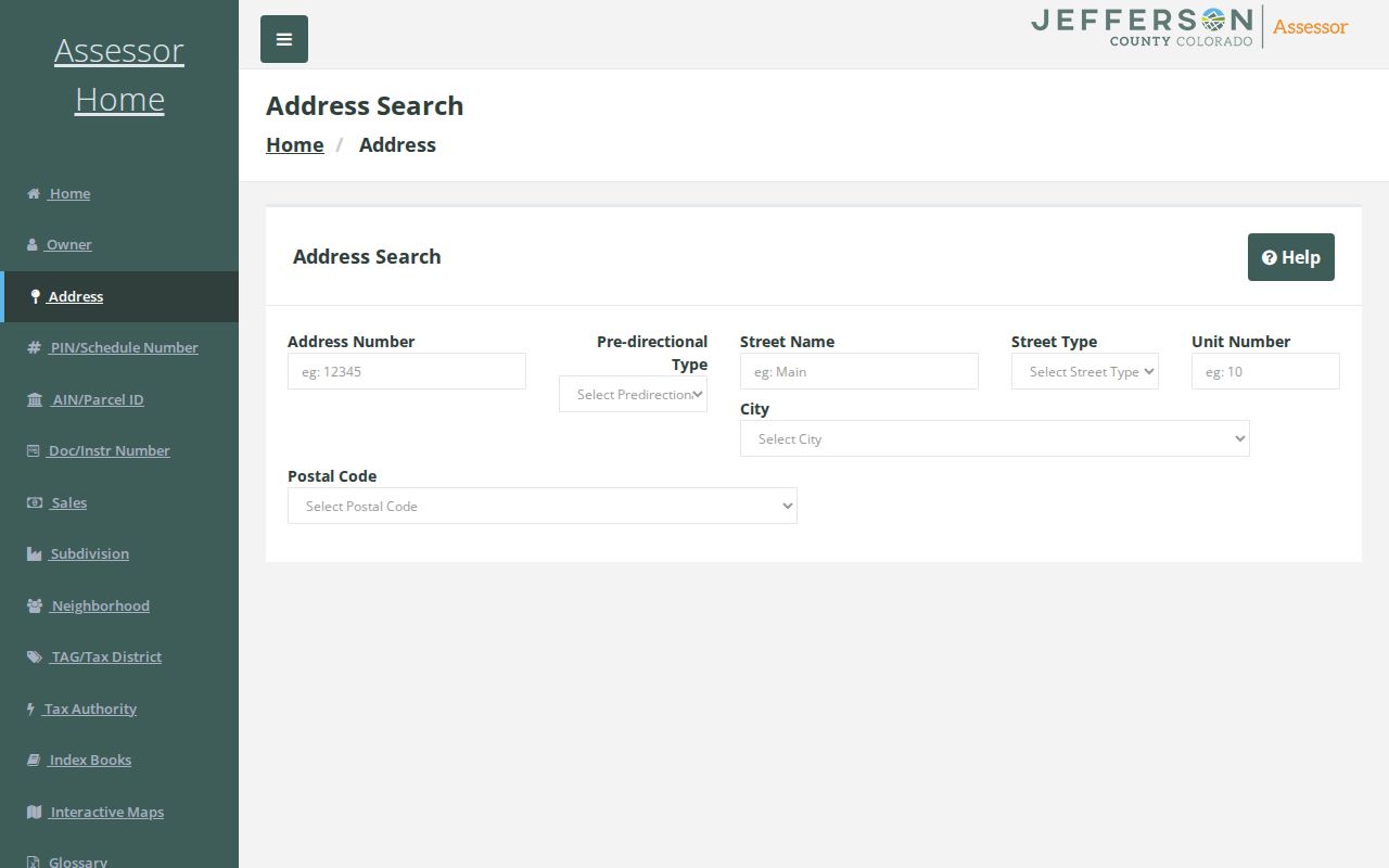
This address-search image is a field reference, not a resident list. Follow the matching PIN or AIN into the parcel card and keep the mailing and situs fields separate.
Wheat Ridge GIS Street Route
Jefferson County GIS supplies the map bridge between an address record and a parcel record. Open the county GIS gallery, choose a property or parcel map, and pan or search to a Wheat Ridge street. At a readable scale, parcel polygons and address labels can be compared. Select the lot, record the PIN, AIN, address, and adjacent parcel identifiers, then open the linked Assessor card. Keep zoning, planning, transportation, hazard, parks, open-space, and district layers turned on only when they answer the question.
A street segment is not the same as a list of households. Click each bordering polygon and distinguish a separate lot from an alley, right of way, common tract, public parcel, school, park, or metro-district parcel. The exact identify and buffer controls were dynamic during research, so the safe instruction is to select and record the parcel rather than promise a radius tool.
The Jefferson County GIS gallery is the official map entry point. Its parcel-viewer capture below gives the visual starting point for Wheat Ridge address research.
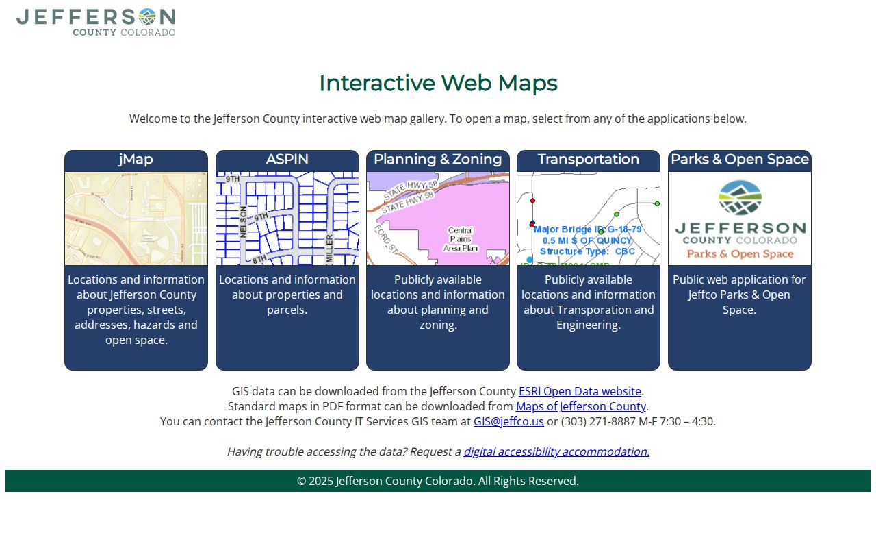
Use the map to find the parcel identifier, then return to the Assessor and recorder. Map geography helps locate a record; it does not establish who is inside a structure.
Note: GIS can show a neighboring polygon and address point, but a dynamic map layer is not a guaranteed roster of all people at that location.
Wheat Ridge Records by Street
A complete address-record review uses several address-keyed sets. Their overlap is useful, but their meanings stay distinct. The Assessor shows a property record. GIS shows geometry. The recorder index shows parties to documents. City permits show a project and its dates. A voter record confirms an individual registration only through its own match or a properly requested extract. Historical directories show an occupant line from a publication year.
| Record set | Keeper | Street clue | Access |
|---|---|---|---|
| Assessor property roll | Jefferson County Assessor | Owner, situs, mailing, PIN/AIN, class, value | Free portal and export |
| GIS parcel layer | Jefferson County GIS | Parcel polygon, address point, adjacent lots, districts | Free map viewer |
| Deed and recording index | Clerk and Recorder | Grantor, grantee, reception number, date, deed type | Free index; images separate |
| City permit files | Wheat Ridge Building Division | Applicant, contractor, inspection, plan, occupancy date | Era-specific portal or request |
| Criss-cross directory | Denver Public Library | Historical address-to-occupant line | Digital or reference access |
| Voter record | Colorado SOS and Elections | Public registration fields for eligible records | Individual match or request |
The parcel identifier is the strongest bridge between present records. A street name can change or be spelled in several ways, while a legal description can remain tied to the lot. Use the address to find the parcel, the parcel to find the deed, and the directory year to find an earlier occupant.
Wheat Ridge Street Deed Chain
To trace ownership along a Wheat Ridge street, begin with the current Assessor card. Copy the current owner, PIN, AIN, legal description, and any sales or history document number. Search the Jefferson County Aumentum Real Estate Index by instrument number or party. A record may reveal a grantor, grantee, recording date, reception number, and deed type. The index is a pointer. Order the image when the legal description, easement, lien, signature, consideration, or transfer language matters.
Use the seller from the current purchase deed as the earlier grantee. Search that person or entity in an earlier period, then reconcile the same legal description. Trusts, estates, corporate names, married names, subdivision changes, and rural descriptions can make a simple street search look broken. If the online index stops, use the Recording Division counter, copy order form, County Archives, or a narrow request. The inspected portal did not expose a verified online start year, so no cutoff should be guessed.
The Aumentum Recorder public index supplies the official entry point. The image below is the manifest capture for that session-dependent search.
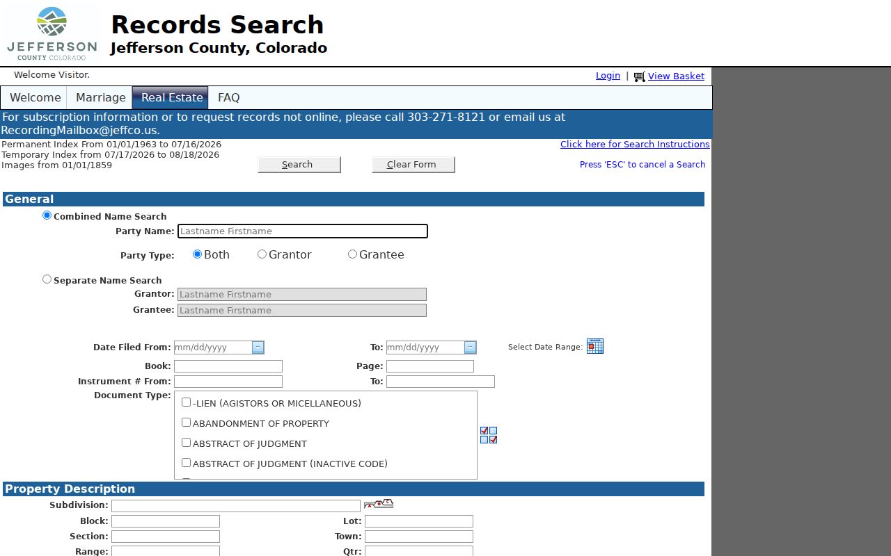
This recorder image belongs beside the parcel trail. A deed party is not automatically the person who lived at the address, so pair the transfer with a directory, census, permit, or obituary clue.
- Grantor
- The person or entity transferring an interest in a recorded document.
- Grantee
- The person or entity receiving the interest in that document.
- Reception number
- The recorder's filing identifier used to locate a recorded document and its copy route.
Wheat Ridge Permit Records
Permit files add dates to an address without pretending to be a resident directory. Wheat Ridge says its building-permit recordkeeping begins with incorporation in 1969. Later material is organized in Laserfiche WebLink under Community Development Archives, with address folders that can contain permits, inspection results, some plans, and certificates of occupancy. The former ADG path covers 2000 through 2024, while OpenGov handles 2025-forward searches by Location or Record number. Older paper files may require an appointment with the Building Division.
These eras explain why one Wheat Ridge street can need several searches. A permit applicant or contractor may be connected to a project but not to the current parcel owner or occupant. Code Enforcement records are also address-keyed, yet the research did not locate a public searchable name or case index. A narrow city request should name the address, file type, and date range.
The Wheat Ridge City Archive search is the best starting point for the archive-era view. Its form accepts keyword, archive, time period, start date, and end date.
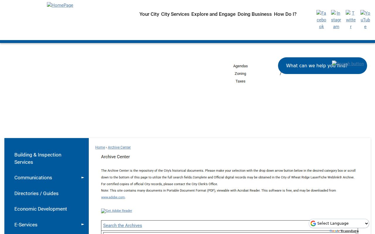
The archive capture connects the address guide to municipal records. A view-only image may need a City Clerk request when a certified copy is required.
Wheat Ridge Street Owner Search
Owner mode is useful when a street number is unclear or when several units share one address. Enter a last name or first name in the Jefferson County Assessor owner form, then read the owner, PIN, AIN, TAG, property address, city, postal code, property class, and mailing address columns. The page can export results and presents 50 rows at a time. Search entity, trust, suffix, and spelling forms only when the source suggests them, and keep each variation in your notes.
The owner result does not answer every street question. An institutional owner, agent, or trust may use a different mailing address. A person listed as owner may not be the occupant, and a multi-unit parcel may have several households. Use GIS for the lot, the recorder for the transfer, and a historical reverse directory for an earlier address-to-occupant clue.
The Jefferson County Assessor owner search is the source for the owner-mode capture below.
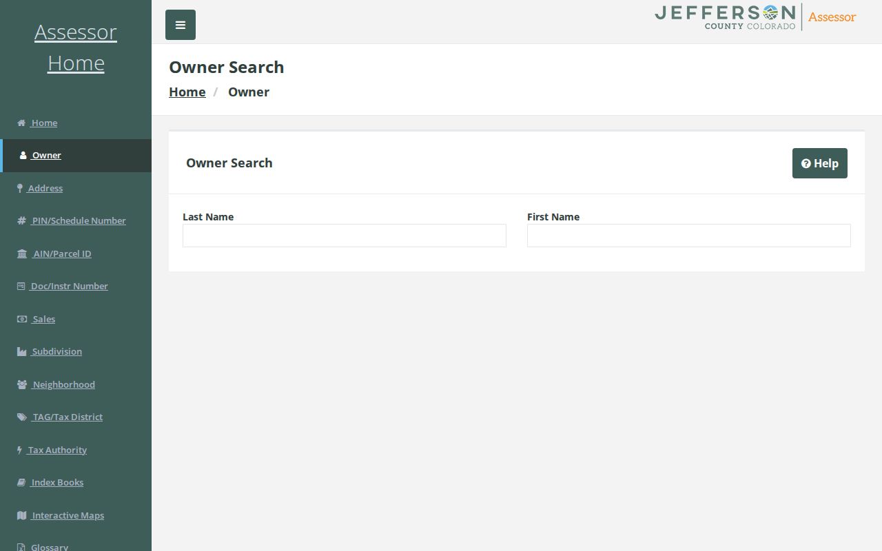
Use this owner form as a second route when an address search fails. The returned mailing field still needs the situs address and parcel card for context.
Wheat Ridge Street Grid and West Side
Address geometry changes across Wheat Ridge. The city uses Ellsworth and Broadway as reference lines. Major blocks use 0 to 99 spacing, odd numbers generally sit west or north, and even numbers generally sit east or south. Primary access controls the assigned number. East of Wadsworth the pattern is older and more compact with a regular grid. West of Wadsworth, curved and rural patterns make subdivision names and legal descriptions more important.
The Community Development Director can change a number or street when a value is out of sequence, has wrong parity, misleads emergency services, duplicates another number, follows a renaming or relocation, or changes with subdivision access. The current Planner of the Day and OpenGov route handles new-address work; the city page says a $25 fee can apply and typical processing is one to two weeks. A historic city-wide renumbering date was not located, so treat an old-number mismatch as a research question rather than a settled story.
Wheat Ridge Criss-Cross Directories
A criss-cross directory turns the address search around. Instead of starting with a name, start with the street number and read the occupant or owner line. Denver Public Library's householder and criss-cross collection runs from 1924 to 2018 in reference form, with a digital run from 1924 to 1937. The broader regional city-directory shelf reaches microfilm from 1866 to 1981 and includes suburban Polk leads for Wheat Ridge in 1969, 1970, 1971, 1975, and 1976.
Read adjacent years together. Record abbreviations, initials, spouse or widow notes, telephone clues, a move to a rural route, and a switch to a nearby locality. A missing name may reflect a publication gap, a different volume, or an old street label rather than an empty structure. The historical reading method and collection map are developed on the Wheat Ridge city directory page so the address page can stay focused on current street work.
Note: A reverse-directory line shows a publication-year clue, not a promise that the same household occupied the address before or after that volume.
Wheat Ridge Street Voter Limits
Colorado voter data can add a public residential address, party affiliation and date, birth year, optional phone or gender identity, and prior participation when the record is eligible. The public lookup itself requires one person's first name, last name, ZIP, and birthday. It is not a street-wide browse. A block or street project needs a county or state data request, a defined election or geography, the listed fee, and the secure-use terms in the request form.
Confidential voters, Address Confidentiality Program participants, preregistrants, and qualifying first responders or spouses can be withheld. Do not reconstruct a protected address from a deed, assessor card, obituary, or another record. A voter address also reflects registration at a point in time, not title, physical presence, or household composition. That boundary is central to responsible Wheat Ridge address research.
Limits of the Wheat Ridge Street Directory
A public street directory cannot show every household member, utility customer, delivery recipient, DMV address, protected voter, sealed court participant, or private association member. A city permit cannot prove current residence. A deed cannot prove occupancy. A commercial people-finder report may merge same-name records and can go stale, so it is only a lead that should be checked against the underlying custodian.
Lawful personal use. Use Wheat Ridge address records for family history, property research, civic questions, or a lawful effort to reconnect. Do not use a name or address trail to stalk, harass, intimidate, or harm anyone.
When the online path is incomplete, use the custodian's fallback: the Recording Division counter or copy form for deeds, the City Clerk for municipal records, the Building Division for older permits, Jefferson County Archives for series-level material, and the library reference desk for reverse directories and microfilm. A complete street directory result is a documented chain of limited facts, not a claim of total human coverage.